
Carte topographique Lossow
Carte interactive
Cliquez sur la carte pour afficher l’altitude.
À propos de cette carte
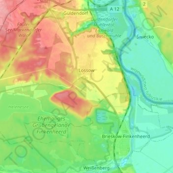
Nom : Carte topographique Lossow, altitude, relief.
Lieu : Lossow, Frankfurt (Oder), Brandenburg, Deutschland (52.25287 14.47216 52.30591 14.60136)
Altitude moyenne : 48 m
Altitude minimum : 14 m
Altitude maximum : 103 m
Autres cartes topographiques
Cliquez sur une carte pour visualiser sa topographie, son altitude et son relief.
Booßen
Deutschland > Brandenburg > Frankfurt (Oder)
Booßen, Frankfurt (Oder), Brandenburg, Deutschland
Altitude moyenne : 72 m
Bullenberg
Deutschland > Brandenburg > Frankfurt (Oder)
Bullenberg, Frankfurt (Oder), Brandenburg, Deutschland
Altitude moyenne : 64 m