
Carte topographique Turracher Höhe
Carte interactive
Cliquez sur la carte pour afficher l’altitude.
Turracher Höhe
The highest point of the approx. two km long pass summit has an altitude of 1,795 m above sea level south of the Turracher Lake. The lake has a water level of 1,763 m above sea (Adria) level and is connected to the village. The Turracher Höhe, as a "classic" pass summit, is also part of a drainage divide between the Mura valley and the Upper Gurk River, whose source is beneath the Lattersteighöhe at approx. 2,000 m above sea level.
À propos de cette carte
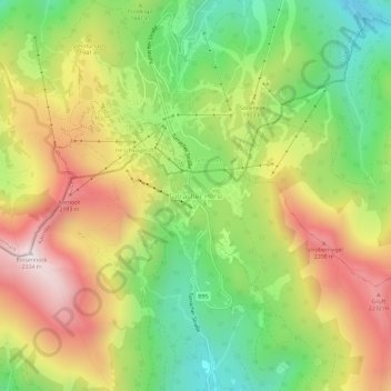
Nom : Carte topographique Turracher Höhe, altitude, relief.
Altitude moyenne : 1 852 m
Altitude minimum : 1 442 m
Altitude maximum : 2 330 m