
Carte topographique Bally
Cliquez sur la carte pour afficher l’altitude.
Bally
Bally is located at 22°39′N 88°20′E / 22.65°N 88.34°E / 22.65; 88.34 and also the northernmost part of Howrah city. It has an average elevation of 15 metres (49 feet). It is more elevated in the west than the east (where flows the Hoogly river), thus leading to a problem of water logging. Bally is separated from Uttarpara, Hooghly by Bally Canal (Bally Khal) at its north. A Bridge was constructed over Bally Canal in 1846 to join the two localities.
À propos de cette carte
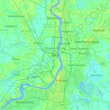
Nom : Carte topographique Bally, altitude, relief.
Lieu : Bally, Bally Jagachha, Howrah, West Bengal, 712258, India (22.48696 88.18361 22.80696 88.50361)
Altitude moyenne : 6 m
Altitude minimum : -3 m
Altitude maximum : 23 m