
Faire un don
Équipez-vous pour votre prochaine aventure :
En tant que Partenaire Amazon, ce site perçoit une commission sur les achats éligibles sans surcoût pour vous.
Carte topographique Sable Island
Cliquez sur la carte pour afficher l’altitude.
Faire un don
Équipez-vous pour votre prochaine aventure :
En tant que Partenaire Amazon, ce site perçoit une commission sur les achats éligibles sans surcoût pour vous.
Sable Island
Sable Island is a narrow, crescent-shaped sandbar with a surface area estimated around 34 km2 (13 sq mi). Despite being approximately 43.15 km (26.81 mi) long, it is only 1.21 km (0.75 mi) across at its widest point. The maximum elevation is about 30 m (98 ft). The long crescent-shaped island rises gently from the shallows of the continental shelf approximately 285 km (177 mi) east of Halifax, Nova Scotia. Its location, in tandem with the area's frequent fog and sudden strong storms (such as hurricanes and nor'easters), have resulted in over 350 recorded shipwrecks. It is often referred to as the Graveyard of the Atlantic, as it sits astride the great circle route from North America's east coast to Europe. The nearest landfall is 160 kilometres (99 mi) to the northwest near Canso, Nova Scotia.
Faire un don
Équipez-vous pour votre prochaine aventure :
En tant que Partenaire Amazon, ce site perçoit une commission sur les achats éligibles sans surcoût pour vous.
À propos de cette carte
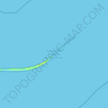
Nom : Carte topographique Sable Island, altitude, relief.
Altitude moyenne : 0 m
Altitude minimum : -5 m
Altitude maximum : 19 m
Faire un don
Équipez-vous pour votre prochaine aventure :
En tant que Partenaire Amazon, ce site perçoit une commission sur les achats éligibles sans surcoût pour vous.