
Carte topographique Billinghay
Carte interactive
Cliquez sur la carte pour afficher l’altitude.
À propos de cette carte
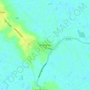
Nom : Carte topographique Billinghay, altitude, relief.
Altitude moyenne : 4 m
Altitude minimum : -1 m
Altitude maximum : 16 m
The settlement is mentioned in the Domesday Book. The name originates from a Saxon name for a fishery. The topography in ancient times would have been that of a small settlement on a gravel mound surrounded by marsh which was flooded in winter. After the draining of the fens in the late 18th century the area became rich agricultural land as it is today. The parish church is of historic interest. It dates from the 13th century.