
Carte topographique Pearl Island
Carte interactive
Cliquez sur la carte pour afficher l’altitude.
À propos de cette carte
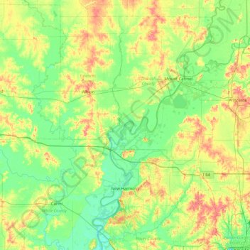
Nom : Carte topographique Pearl Island, altitude, relief.
Lieu : Pearl Island, Gibson County, Indiana, USA (37.97088 -88.25503 38.61088 -87.61503)
Altitude moyenne : 130 m
Altitude minimum : 105 m
Altitude maximum : 184 m
Autres cartes topographiques
Cliquez sur une carte pour visualiser sa topographie, son altitude et son relief.
Wilson Wisely Ditch
Wilson Wisely Ditch, Pulaski County, Indiana, USA
Altitude moyenne : 220 m
Middle Fork of Wildcat Creek
Middle Fork of Wildcat Creek, Clinton County, Indiana, 46065, USA
Altitude moyenne : 215 m
Lake Windemere
Lake Windemere, Sedgemoor Circle, North Augusta Addition, Carmel, Hamilton County, Indiana, 46032, USA
Altitude moyenne : 273 m