
Carte topographique Phú Hộ
Carte interactive
Cliquez sur la carte pour afficher l’altitude.
À propos de cette carte
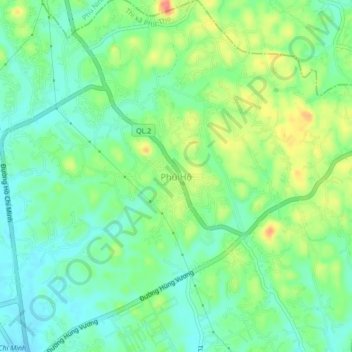
Nom : Carte topographique Phú Hộ, altitude, relief.
Lieu : Phú Hộ, Province de Phú Thọ, Viêt Nam (21.41983 105.23432 21.45983 105.27432)
Altitude moyenne : 38 m
Altitude minimum : 14 m
Altitude maximum : 81 m
Autres cartes topographiques
Cliquez sur une carte pour visualiser sa topographie, son altitude et son relief.
Thị xã Phú Thọ
Viêt Nam > Province de Phú Thọ > Thị xã Phú Thọ
Thị xã Phú Thọ, Province de Phú Thọ, Viêt Nam
Altitude moyenne : 30 m