
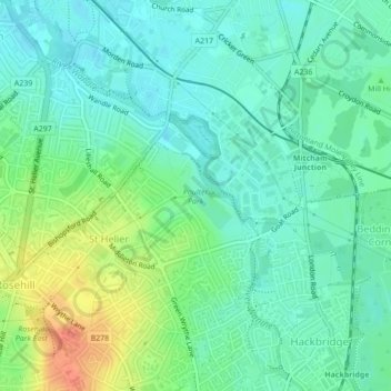
Carte topographique Poulter Park
Carte interactive
Cliquez sur la carte pour afficher l’altitude.
À propos de cette carte
Nom : Carte topographique Poulter Park, altitude, relief.
Altitude moyenne : 31 m
Altitude minimum : 16 m
Altitude maximum : 62 m
Autres cartes topographiques
Cliquez sur une carte pour visualiser sa topographie, son altitude et son relief.
Elephant Park
United Kingdom > England > Greater London > London
Elephant Park, Browning Estate, Elephant and Castle, London, London Borough of Southwark, Greater London, England, SE17, United Kingdom
Altitude moyenne : 7 m
Sunnyhill Park
United Kingdom > England > Greater London > London
Sunnyhill Park, Hendon, London, London Borough of Barnet, Greater London, England, United Kingdom
Altitude moyenne : 62 m