
Carte topographique La Grange
Carte interactive
Cliquez sur la carte pour afficher l’altitude.
À propos de cette carte
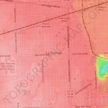
Nom : Carte topographique La Grange, altitude, relief.
Lieu : La Grange, Cook County, Illinois, United States of America (41.79017 -87.88943 41.82007 -87.85919)
Altitude moyenne : 199 m
Altitude minimum : 99 m
Altitude maximum : 210 m
La Grange is located at 41°48′29″N 87°52′24″W / 41.80806°N 87.87333°W / 41.80806; -87.87333 (41.807938, -87.873455), about 13 miles (21 km) west of Chicago. The village is roughly flat, only deviating from the elevation of 645 feet by at most ten feet. La Grange is surrounded by incorporated places of similar sizes on all sides except to the South West, where the generously-named La Grange Highlands are.