
Carte topographique Sarnia Skała
Carte interactive
Cliquez sur la carte pour afficher l’altitude.
À propos de cette carte
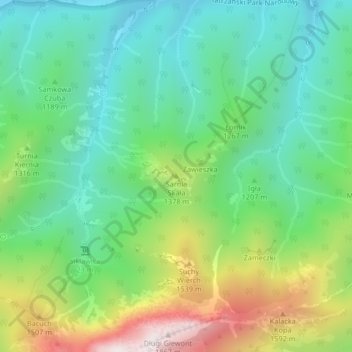
Nom : Carte topographique Sarnia Skała, altitude, relief.
Altitude moyenne : 1 206 m
Altitude minimum : 913 m
Altitude maximum : 1 824 m
Autres cartes topographiques
Cliquez sur une carte pour visualiser sa topographie, son altitude et son relief.
Wielki Giewont
Poland > Lesser Poland Voivodeship > Tatra County > Zakopane
Wielki Giewont, Zakopane, Tatra County, Lesser Poland Voivodeship, Poland
Altitude moyenne : 1 478 m
Tatry
Poland > Lesser Poland Voivodeship > Tatra County > Zakopane
Tatry, Zakopane, Tatra County, Lesser Poland Voivodeship, Poland
Altitude moyenne : 1 647 m