
Carte topographique Tengboche
Carte interactive
Cliquez sur la carte pour afficher l’altitude.
À propos de cette carte
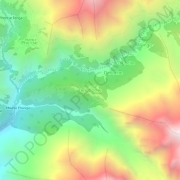
Nom : Carte topographique Tengboche, altitude, relief.
Altitude moyenne : 3 936 m
Altitude minimum : 3 215 m
Altitude maximum : 4 970 m
Tengboche is a midway station on the trail to the base camp for the mountain climbers of Mount Everest and other peaks of over 8,000 metres (26,000 ft) elevation; all these areas form part of the entire Khumbu region up to Tibet border with an area of 1,148 square kilometres (443 sq mi) encompassing Sagarmatha National Park. In the Khumbu region of Nepal, the monastery is strategically placed on the way to Everest base camp and thus attracts large number of tourists from all parts of the world. During the spring season, hill slopes around Tengboche are covered with flowering rhododendrons.