
Carte topographique Stavro
Carte interactive
Cliquez sur la carte pour afficher l’altitude.
À propos de cette carte
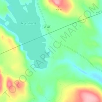
Nom : Carte topographique Stavro, altitude, relief.
Altitude moyenne : 408 m
Altitude minimum : 364 m
Altitude maximum : 508 m
Autres cartes topographiques
Cliquez sur une carte pour visualiser sa topographie, son altitude et son relief.
Grundtjärn
Sweden > Västernorrland County > Anundsjö District
Grundtjärn, Anundsjö District, Örnsköldsviks kommun, Västernorrland County, Sweden
Altitude moyenne : 278 m