
Carte topographique Georgetown
Carte interactive
Cliquez sur la carte pour afficher l’altitude.
À propos de cette carte
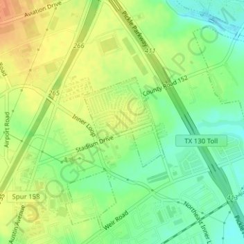
Nom : Carte topographique Georgetown, altitude, relief.
Lieu : Georgetown, Williamson County, Texas, United States (30.66650 -97.66000 30.67646 -97.64954)
Altitude moyenne : 219 m
Altitude minimum : 200 m
Altitude maximum : 236 m
The city is located on the northeastern edge of Texas Hill Country. Portions of Georgetown are located on either side of the Balcones Escarpment, a fault line in which the areas roughly east of IH-35 are flat and characterized by having black, fertile soils of the Blackland Prairie, and the west side of the escarpment which consists mostly of hilly, karst-like terrain with little topsoil and higher elevations and which is part of the Texas Hill Country. Inner Space Cavern, a large cave, is a major tourist attraction found on the south side of the city, just west of Interstate 35, and is a large-scale example of limestone karst formations.