
Carte topographique Noothanchery
Carte interactive
Cliquez sur la carte pour afficher l’altitude.
À propos de cette carte
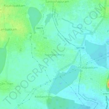
Nom : Carte topographique Noothanchery, altitude, relief.
Altitude moyenne : 12 m
Altitude minimum : 4 m
Altitude maximum : 34 m
Autres cartes topographiques
Cliquez sur une carte pour visualiser sa topographie, son altitude et son relief.
Vengaivasal Panchayat office
India > Tamil Nadu > Tambaram > Noothanchery
Vengaivasal Panchayat office, Noothanchery, Tambaram, Chengalpattu District, Tamil Nadu, 600126, India
Altitude moyenne : 12 m