
Carte topographique Etsch - Adige
Carte interactive
Cliquez sur la carte pour afficher l’altitude.
À propos de cette carte
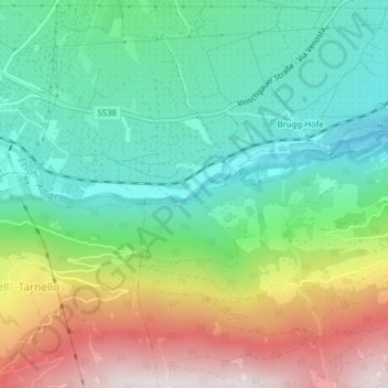
Nom : Carte topographique Etsch - Adige, altitude, relief.
Altitude moyenne : 1 083 m
Altitude minimum : 763 m
Altitude maximum : 1 666 m
Autres cartes topographiques
Cliquez sur une carte pour visualiser sa topographie, son altitude et son relief.
Etsch - Adige
Italy > Trentino-Alto Adige/Südtirol > South Tyrol > Tarnell - Tarnello > Oberplatz
Etsch - Adige, Oberplatz, Tarnell - Tarnello, Laas - Lasa, Vinschgau - Val Venosta, South Tyrol, Trentino-Alto Adige/Südtirol, 39023, Italy
Altitude moyenne : 1 075 m