
Carte topographique Farsala
Carte interactive
Cliquez sur la carte pour afficher l’altitude.
Farsala
The Pharsalos of the historic era was built over a hillside of the Narthacius mountains at an elevation of some 160 m, where modern Farsala stands. It was one of the main cities in Thessaly and was the capital of the Phthian tetrarch. It was also a polis (city-state).
À propos de cette carte
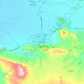
Nom : Carte topographique Farsala, altitude, relief.
Altitude moyenne : 215 m
Altitude minimum : 122 m
Altitude maximum : 523 m