
Carte topographique Mohnyin Township
Carte interactive
Cliquez sur la carte pour afficher l’altitude.
À propos de cette carte
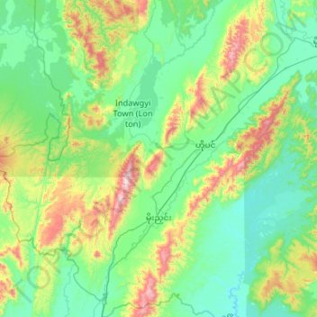
Nom : Carte topographique Mohnyin Township, altitude, relief.
Lieu : Mohnyin Township, Mohnyin District, Kachin, Myanmar (24.47977 95.80617 25.43046 96.80599)
Altitude moyenne : 350 m
Altitude minimum : 94 m
Altitude maximum : 1 518 m
Autres cartes topographiques
Cliquez sur une carte pour visualiser sa topographie, son altitude et son relief.
Nong Mae Mai Lake
Myanmar > Kachin > Mohnyin District
Nong Mae Mai Lake, Mohnyin District, Kachin, Myanmar
Altitude moyenne : 249 m
Mogaung Township
Myanmar > Kachin > Mohnyin District > Mogaung Township
Mogaung Township, Mohnyin District, Kachin, ၁၁၀၂, Myanmar
Altitude moyenne : 346 m