
Carte topographique Helena-West Helena
Carte interactive
Cliquez sur la carte pour afficher l’altitude.
Helena-West Helena
The city of Helena was founded by European Americans in 1833, as a port along the Mississippi River. Crowleys Ridge provided elevation and some protection against flooding, a rare feature along the right/west bank of the lower Mississippi River.
À propos de cette carte
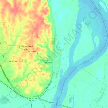
Nom : Carte topographique Helena-West Helena, altitude, relief.
Altitude moyenne : 67 m
Altitude minimum : 43 m
Altitude maximum : 124 m