
Carte topographique Kirkland Lake
Carte interactive
Cliquez sur la carte pour afficher l’altitude.
Kirkland Lake
Kirkland Lake is located in the resource-rich Precambrian Shield, an ancient geological core of the North American continent. Nearby is the Arctic Watershed, a drainage divide at an elevation of 318 m (1,043 ft). Rivers south of that elevation flow into a drainage basin which includes Lake Ontario and the Saint Lawrence River, while rivers north of the watershed flow into Hudson Bay.
À propos de cette carte
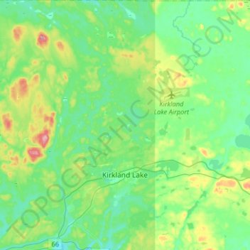
Nom : Carte topographique Kirkland Lake, altitude, relief.
Altitude moyenne : 332 m
Altitude minimum : 294 m
Altitude maximum : 443 m