
Carte topographique The Vly
Carte interactive
Cliquez sur la carte pour afficher l’altitude.
À propos de cette carte
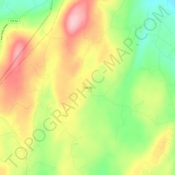
Nom : Carte topographique The Vly, altitude, relief.
Altitude moyenne : 254 m
Altitude minimum : 160 m
Altitude maximum : 346 m
Autres cartes topographiques
Cliquez sur une carte pour visualiser sa topographie, son altitude et son relief.
Mohonk Mountain House Property
United States > New York > Ulster County > Town of Marbletown
Mohonk Mountain House Property, Town of Marbletown, Town of Rochester, Ulster County, New York, United States
Altitude moyenne : 228 m
Stone Ridge
United States > New York > Ulster County > Town of Marbletown
Stone Ridge, Town of Marbletown, Ulster County, New York, United States
Altitude moyenne : 93 m
High Falls
United States > New York > Ulster County > Town of Marbletown
High Falls, Town of Marbletown, Ulster County, New York, United States
Altitude moyenne : 77 m