
Carte topographique Dhandhuka
Carte interactive
Cliquez sur la carte pour afficher l’altitude.
À propos de cette carte
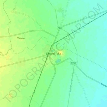
Nom : Carte topographique Dhandhuka, altitude, relief.
Altitude moyenne : 21 m
Altitude minimum : 13 m
Altitude maximum : 30 m
Dhandhuka is located at 22°22′N 71°59′E / 22.37°N 71.98°E / 22.37; 71.98. It has an average elevation of 24 metres (78 feet). The city is 105 km from District center Ahmedabad, on state highway No 1. to Bhavnagar. Bhavnagar is 95 km from Dhandhuka town.