
Carte topographique Ponchatoula
Carte interactive
Cliquez sur la carte pour afficher l’altitude.
Ponchatoula
Ponchatoula is located at 30°26′21″N 90°26′33″W / 30.43917°N 90.44250°W / 30.43917; -90.44250 (30.439162, -90.442507) and has an elevation of 26 feet (7.9 m). According to the United States Census Bureau, the city has a total area of 4.2 square miles (11 km2), all land.
À propos de cette carte
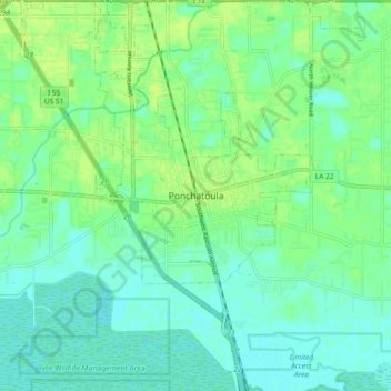
Nom : Carte topographique Ponchatoula, altitude, relief.
Altitude moyenne : 7 m
Altitude minimum : 1 m
Altitude maximum : 14 m