
Carte topographique Turtle River
Carte interactive
Cliquez sur la carte pour afficher l’altitude.
À propos de cette carte
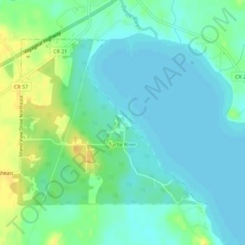
Nom : Carte topographique Turtle River, altitude, relief.
Lieu : Turtle River, Beltrami County, Minnesota, United States (47.58074 -94.76833 47.59905 -94.73779)
Altitude moyenne : 405 m
Altitude minimum : 397 m
Altitude maximum : 422 m
Turtle River is a town in Beltrami County, Minnesota, United States. The population was 77 at the 2010 census. The elevation is 1,332 ft (406m). It is approximately 17 miles northeast of Bemidji, where most community services are available. Turtle River consists of two stores, a restaurant, a gas station, and a church.