
Carte topographique Lackenroe
Carte interactive
Cliquez sur la carte pour afficher l’altitude.
À propos de cette carte
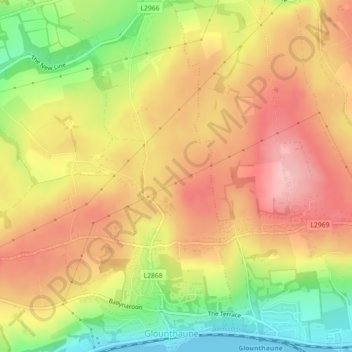
Nom : Carte topographique Lackenroe, altitude, relief.
Altitude moyenne : 88 m
Altitude minimum : 0 m
Altitude maximum : 153 m
Autres cartes topographiques
Cliquez sur une carte pour visualiser sa topographie, son altitude et son relief.
Cobh
Ireland > County Cork > Cobh Municipal District > Cobh
Cobh, Cobh Municipal District, County Cork, Munster, P43 XV65, Ireland
Altitude moyenne : 23 m