
Carte topographique Kothagudem
Cliquez sur la carte pour afficher l’altitude.
Kothagudem
Kothagudem is located at 17°33′00″N 80°37′05″E / 17.55°N 80.618°E / 17.55; 80.618. It has an average elevation of 89 metres (295 ft) above sea level. The North of Kothagudem borders Chhattisgarh state which is approximately 120 km from the town.
À propos de cette carte
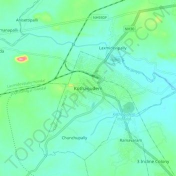
Nom : Carte topographique Kothagudem, altitude, relief.
Altitude moyenne : 109 m
Altitude minimum : 81 m
Altitude maximum : 230 m