
Carte topographique Lębork
Carte interactive
Cliquez sur la carte pour afficher l’altitude.
À propos de cette carte
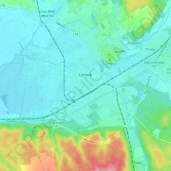
Nom : Carte topographique Lębork, altitude, relief.
Lieu : Lębork, Lębork County, Pomeranian Voivodeship, 84-300, Poland (54.51208 17.70993 54.55910 17.80564)
Altitude moyenne : 40 m
Altitude minimum : 12 m
Altitude maximum : 137 m
Autres cartes topographiques
Cliquez sur une carte pour visualiser sa topographie, son altitude et son relief.
Rąbka
Poland > Pomeranian Voivodeship > Lębork County > Łeba
Rąbka, Łeba, Lębork County, Pomeranian Voivodeship, 84-360, Poland
Altitude moyenne : -1 m
Lębork
Poland > Pomeranian Voivodeship > Lębork County > Lębork
Lębork, Lębork County, Pomeranian Voivodeship, 84-300, Poland
Altitude moyenne : 39 m