
Carte topographique Town of Mayerthorpe
Carte interactive
Cliquez sur la carte pour afficher l’altitude.
À propos de cette carte
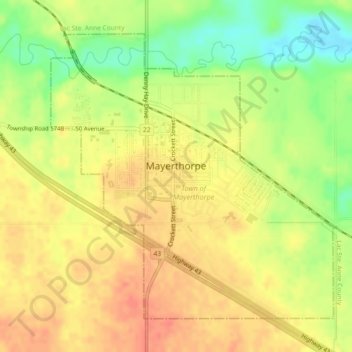
Nom : Carte topographique Town of Mayerthorpe, altitude, relief.
Altitude moyenne : 711 m
Altitude minimum : 681 m
Altitude maximum : 730 m
Autres cartes topographiques
Cliquez sur une carte pour visualiser sa topographie, son altitude et son relief.
Grassland
Canada > Alberta > Division No. 13
Grassland, Division No. 13, Alberta, T0A 1V0, Canada
Altitude moyenne : 584 m