
Carte topographique Mount Sunflower
Carte interactive
Cliquez sur la carte pour afficher l’altitude.
Mount Sunflower
Mount Sunflower, although not a true mountain, is the highest natural point in the U.S. state of Kansas. At 4,039 feet (1,231 m), it is 3,300 feet (1,010 m) above the state's topographic low point, which lies on the opposite side of the state. It is located between the communities of Kanorado and Weskan in Wallace County, less than half a mile (0.8 km) from the state border with Colorado and is close to the lowest point in Colorado.
À propos de cette carte
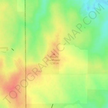
Nom : Carte topographique Mount Sunflower, altitude, relief.
Lieu : Mount Sunflower, Wallace County, Kansas, United States (39.02188 -102.03730 39.02198 -102.03720)
Altitude moyenne : 1 215 m
Altitude minimum : 1 186 m
Altitude maximum : 1 239 m
Autres cartes topographiques
Cliquez sur une carte pour visualiser sa topographie, son altitude et son relief.