
Carte topographique Ogilvie Lagoon
Carte interactive
Cliquez sur la carte pour afficher l’altitude.
À propos de cette carte
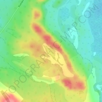
Nom : Carte topographique Ogilvie Lagoon, altitude, relief.
Altitude moyenne : 49 m
Altitude minimum : 17 m
Altitude maximum : 93 m
Autres cartes topographiques
Cliquez sur une carte pour visualiser sa topographie, son altitude et son relief.
Ruatapu
Ruatapu, Westland District, West Coast, 7883, New Zealand
Altitude moyenne : 11 m
Totara Lagoon
Totara Lagoon, Paiere Road, Ruatapu, Westland District, West Coast, 7883, New Zealand
Altitude moyenne : 10 m