
Carte topographique Emerson
Carte interactive
Cliquez sur la carte pour afficher l’altitude.
À propos de cette carte
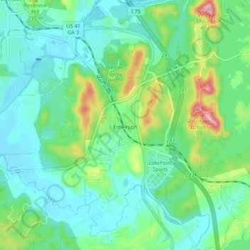
Nom : Carte topographique Emerson, altitude, relief.
Lieu : Emerson, Bartow County, Georgia, 30137, United States (34.09402 -84.78494 34.16097 -84.71986)
Altitude moyenne : 254 m
Altitude minimum : 205 m
Altitude maximum : 402 m
Autres cartes topographiques
Cliquez sur une carte pour visualiser sa topographie, son altitude et son relief.
Rydal
United States > Georgia > Bartow County > Rydal
Rydal, Bartow County, Georgia, 30139:30171:30184, United States
Altitude moyenne : 273 m
White
United States > Georgia > Bartow County > White
White, Bartow County, Georgia, United States
Altitude moyenne : 271 m
Cartersville
United States > Georgia > Bartow County
Cartersville, Bartow County, Georgia, 30120, United States
Altitude moyenne : 260 m