
Carte topographique Lake Worth Beach
Carte interactive
Cliquez sur la carte pour afficher l’altitude.
À propos de cette carte
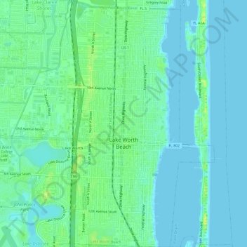
Nom : Carte topographique Lake Worth Beach, altitude, relief.
Altitude moyenne : 6 m
Altitude minimum : -3 m
Altitude maximum : 17 m
Lake Worth Beach is located at 26°37′11″N 80°3′31″W / 26.61972°N 80.05861°W / 26.61972; -80.05861, bordering West Palm Beach to the north, Lake Clarke Shores to the northeast, and Lantana to the south. The municipal beach section of the city borders Palm Beach, while Lake Worth Beach is also located just east of Palm Springs. Lake Worth Beach is located about 64 miles (103 km) north of Miami. According to the United States Census Bureau, the city has a total area of 6.81 square miles (18 km2), of which 5.89 square miles (15 km2) is land and 0.92 square miles (2 km2) (13.51%) is water. The average elevation of Lake Worth Beach is 16 ft (4.9 m).