
Carte topographique Clausnitz
Cliquez sur la carte pour afficher l’altitude.
À propos de cette carte
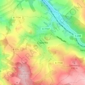
Nom : Carte topographique Clausnitz, altitude, relief.
Altitude moyenne : 609 m
Altitude minimum : 501 m
Altitude maximum : 718 m
Autres cartes topographiques
Cliquez sur une carte pour visualiser sa topographie, son altitude et son relief.
Freiberg
Germany > Saxony > Mittelsachsen
The town lies on the northern declivity of the Ore Mountains, with the majority of the borough west of the Eastern or Freiberger Mulde river. Parts of the town are nestled in the valleys of Münzbach and Goldbach streams. Its centre has an altitude of about 412 m above sea level (NHN) (at the railway station).…
Altitude moyenne : 405 m