
Carte topographique Monte Patón
Carte interactive
Cliquez sur la carte pour afficher l’altitude.
À propos de cette carte
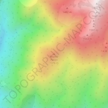
Nom : Carte topographique Monte Patón, altitude, relief.
Altitude moyenne : 1 144 m
Altitude minimum : 667 m
Altitude maximum : 1 668 m
Autres cartes topographiques
Cliquez sur une carte pour visualiser sa topographie, son altitude et son relief.
Charco Zarco
Espagne > Castille-et-León > Candeleda
Charco Zarco, Candeleda, Ávila, Castille-et-León, Espagne
Altitude moyenne : 1 734 m