
Carte topographique The Sandhills
Carte interactive
Cliquez sur la carte pour afficher l’altitude.
À propos de cette carte
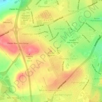
Nom : Carte topographique The Sandhills, altitude, relief.
Altitude moyenne : 82 m
Altitude minimum : 32 m
Altitude maximum : 118 m
Autres cartes topographiques
Cliquez sur une carte pour visualiser sa topographie, son altitude et son relief.
Mowbray Park
United Kingdom > England > Sunderland
Mowbray Park, Ashbrooke, Sunderland, Tyne and Wear, North East England, England, United Kingdom
Altitude moyenne : 26 m