
Carte topographique Douglasville
Carte interactive
Cliquez sur la carte pour afficher l’altitude.
Douglasville
Located along a natural rise in the topography, Douglasville was originally known as "Skint Chestnut."[6] The name was derived from a large tree used by Native Americans as a landmark; it was stripped of its bark so as to be more conspicuous.
À propos de cette carte
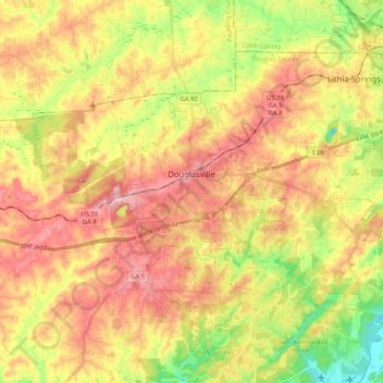
Nom : Carte topographique Douglasville, altitude, relief.
Lieu : Douglasville, Douglas County, Georgia, United States (33.69597 -84.79482 33.79098 -84.58940)
Altitude moyenne : 310 m
Altitude minimum : 218 m
Altitude maximum : 389 m