
Carte topographique Sausar
Carte interactive
Cliquez sur la carte pour afficher l’altitude.
Sausar
Sausar is located at 21°39′N 78°47′E / 21.65°N 78.78°E / 21.65; 78.78 in central India. It has an average elevation of 352 metres (1,154 feet). The Jam and Kanhan Rivers are the main rivers in Sausar. The city is situated between the two rivers.
À propos de cette carte
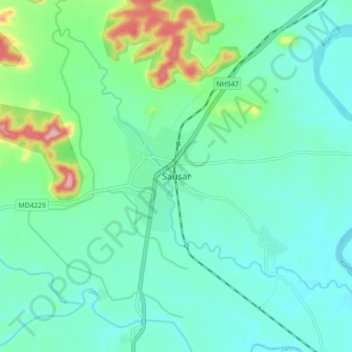
Nom : Carte topographique Sausar, altitude, relief.
Altitude moyenne : 365 m
Altitude minimum : 326 m
Altitude maximum : 507 m