
Carte topographique Neef
Carte interactive
Cliquez sur la carte pour afficher l’altitude.
À propos de cette carte
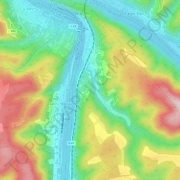
Nom : Carte topographique Neef, altitude, relief.
Altitude moyenne : 213 m
Altitude minimum : 84 m
Altitude maximum : 411 m
Winegrowing and tourism are the underpinnings of Neef's economy. A side route on the Mosel-Radweg (Moselle Cycle Path), which runs through the municipality, yearly brings thousands of tourists to the village, who often stay overnight. Vineyards can be found from the village itself right up to an elevation of 280 m. One peculiarity is the local vineyards at the bow in the Moselle near Neef: those on the Frauenberg and the Calmont are among Europe's steepest vineyards.