
Carte topographique Rahin
Carte interactive
Cliquez sur la carte pour afficher l’altitude.
À propos de cette carte
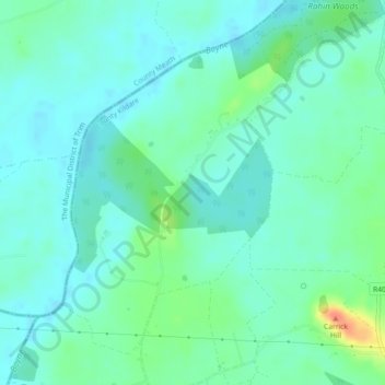
Nom : Carte topographique Rahin, altitude, relief.
Altitude moyenne : 74 m
Altitude minimum : 63 m
Altitude maximum : 108 m
Autres cartes topographiques
Cliquez sur une carte pour visualiser sa topographie, son altitude et son relief.
Ballyshannon
Ballyshannon, Ballyshannon ED, The Municipal District of Athy, Comté de Kildare, Leinster, Irlande
Altitude moyenne : 105 m
Collin
Collin, Carrigeen ED, The Municipal District of Athy, Comté de Kildare, Leinster, Irlande
Altitude moyenne : 169 m
Reeves
Reeves, Donaghcumper ED, The Municipal District of Celbridge — Leixlip, Comté de Kildare, Leinster, Irlande
Altitude moyenne : 61 m
Athy
Athy, Athy Urban East ED, The Municipal District of Athy, Comté de Kildare, Leinster, R14 XD30, Irlande
Altitude moyenne : 61 m