

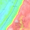
Carte topographique Horton
Cliquez sur la carte pour afficher l’altitude.
À propos de cette carte

Nom : Carte topographique Horton, altitude, relief.
Lieu : Horton, DeKalb County, Alabama, United States (34.36453 -85.86636 34.40453 -85.82636)
Altitude moyenne : 320 m
Altitude minimum : 229 m
Altitude maximum : 392 m
Autres cartes topographiques
Cliquez sur une carte pour visualiser sa topographie, son altitude et son relief.


Mentone
United States > Alabama > DeKalb County
Mentone is located in eastern DeKalb County at 34°34′20″N 85°34′49″W / 34.57222°N 85.58028°W / 34.57222; -85.58028 (34.572360, -85.580283). It is bordered to the west by the town of Valley Head. The center of town is located on the crest of Lookout Mountain at an elevation of 1,736 feet…
Altitude moyenne : 471 m


Little River Canyon National Preserve
United States > Alabama > DeKalb County > Fort Payne
Altitude moyenne : 328 m


Mentone
United States > Alabama > DeKalb County
Mentone is located in eastern DeKalb County at 34°34′20″N 85°34′49″W / 34.57222°N 85.58028°W / 34.57222; -85.58028 (34.572360, -85.580283). It is bordered to the west by the town of Valley Head. The center of town is located on the crest of Lookout Mountain at an elevation of 1,736 feet…
Altitude moyenne : 471 m