
Carte topographique Hwachon-myeon
Carte interactive
Cliquez sur la carte pour afficher l’altitude.
À propos de cette carte
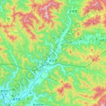
Nom : Carte topographique Hwachon-myeon, altitude, relief.
Lieu : Hwachon-myeon, Hongcheon-gun, Gangwon State, South Korea (37.69199 127.85465 37.87135 128.12499)
Altitude moyenne : 379 m
Altitude minimum : 113 m
Altitude maximum : 985 m
Autres cartes topographiques
Cliquez sur une carte pour visualiser sa topographie, son altitude et son relief.
Gurun-ri
South Korea > Hongcheon-gun > Hwachon-myeon
Gurun-ri, Hwachon-myeon, Hongcheon-gun, Gangwon State, 25158, South Korea
Altitude moyenne : 298 m