
Carte topographique Kasungu National Park
Carte interactive
Cliquez sur la carte pour afficher l’altitude.
À propos de cette carte
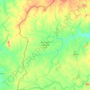
Nom : Carte topographique Kasungu National Park, altitude, relief.
Altitude moyenne : 1 087 m
Altitude minimum : 940 m
Altitude maximum : 1 499 m
Kasungu National Park, established in 1970, is the second-largest in Malawi at 2,316 square kilometres (894 sq mi), with an elevation of approximately 1,000 metres (3,300 ft) above sea level on average. It is located in the Central Region approximately 165 km (103 mi) north of Lilongwe.
Autres cartes topographiques
Cliquez sur une carte pour visualiser sa topographie, son altitude et son relief.