
Carte topographique Jazīrat ‘Awwāḑ
Carte interactive
Cliquez sur la carte pour afficher l’altitude.
À propos de cette carte
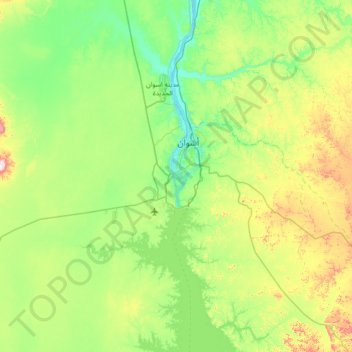
Nom : Carte topographique Jazīrat ‘Awwāḑ, altitude, relief.
Lieu : Jazīrat ‘Awwāḑ, Shash, Aswan, 81531, Egypt (23.70792 32.55275 24.34792 33.19275)
Altitude moyenne : 201 m
Altitude minimum : 80 m
Altitude maximum : 541 m
Autres cartes topographiques
Cliquez sur une carte pour visualiser sa topographie, son altitude et son relief.
Aswan Low Dam (Khazzan Aswan)
Aswan Low Dam (Khazzan Aswan), Shash, Aswan, Egypt
Altitude moyenne : 113 m