

Carte topographique Bayreuth
Cliquez sur la carte pour afficher l’altitude.
Bayreuth
In most places there is a signed cycle path network. In the centre of Bayreuth itself, cycling is fairly straightforward due to the relatively flat topography, something which encourages the use bicycles as an everyday means of transport. Because of the proximity of the 600 kilometre long Main Cycle Path, Bayreuth is also a destination for many tourist cycle routes. Because of the long service intervals of the Bayreuth town bus system and its long overnight pause, students use bicycles as their everyday mode of transport. Bicycles may be carried for a fee on DB Regio trains leaving Bayreuth and in the VGN's buses.
À propos de cette carte
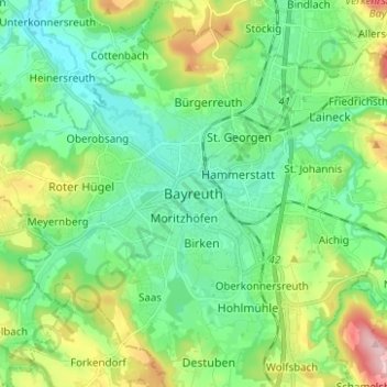
Nom : Carte topographique Bayreuth, altitude, relief.
Lieu : Bayreuth, Upper Franconia, Bavaria, 95444, Germany (49.90272 11.53631 49.98272 11.61631)
Altitude moyenne : 377 m
Altitude minimum : 318 m
Altitude maximum : 527 m