
Carte topographique Alfred
Carte interactive
Cliquez sur la carte pour afficher l’altitude.
Alfred
The elevation of Alfred is about 1,700 feet (520 m) but rises to a high point of 2,355 feet (718 m) at the summit of Jericho Hill just south of the village. The hills greatly affect the weather in the region, which results in quick changes as well as different conditions in neighboring valleys.
À propos de cette carte
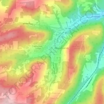
Nom : Carte topographique Alfred, altitude, relief.
Altitude moyenne : 604 m
Altitude minimum : 484 m
Altitude maximum : 712 m