
Carte topographique Échanson
Carte interactive
Cliquez sur la carte pour afficher l’altitude.
À propos de cette carte
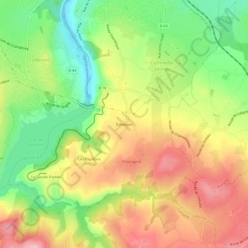
Nom : Carte topographique Échanson, altitude, relief.
Altitude moyenne : 365 m
Altitude minimum : 268 m
Altitude maximum : 464 m
Autres cartes topographiques
Cliquez sur une carte pour visualiser sa topographie, son altitude et son relief.
La Goutte Fronde
France > Auvergne-Rhône-Alpes > Loire > Commelle-Vernay
La Goutte Fronde, Commelle-Vernay, Roanne, Loire, Auvergne-Rhône-Alpes, France métropolitaine, 42120, France
Altitude moyenne : 375 m