
Carte topographique East (Andrews) Park
Carte interactive
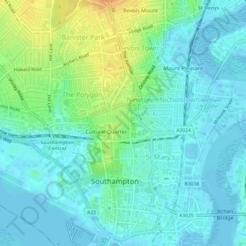
Cliquez sur la carte pour afficher l’altitude.
À propos de cette carte
Nom : Carte topographique East (Andrews) Park, altitude, relief.
Altitude moyenne : 9 m
Altitude minimum : -2 m
Altitude maximum : 32 m
Autres cartes topographiques
Cliquez sur une carte pour visualiser sa topographie, son altitude et son relief.
Southampton
United Kingdom > England > Southampton
Southampton, South East England, England, SO14 2BY, United Kingdom
Altitude moyenne : 38 m