
Carte topographique Osijek
Carte interactive
Cliquez sur la carte pour afficher l’altitude.
Osijek
Osijek (Croatian pronunciation: (listen)) is the fourth largest city in Croatia with a population of 108,048 in 2011. It is the largest city and the economic and cultural centre of the eastern Croatian region of Slavonia, as well as the administrative centre of Osijek-Baranja County. Osijek is located on the right bank of the Drava river, 25 kilometres (16 mi) upstream of its confluence with the Danube, at an elevation of 94 metres (308 ft).
À propos de cette carte
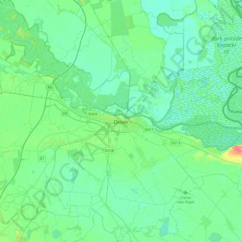
Nom : Carte topographique Osijek, altitude, relief.
Lieu : Osijek, Grad Osijek, Osijek-Baranja County, 31000, Croatia (45.39487 18.53537 45.71487 18.85537)
Altitude moyenne : 87 m
Altitude minimum : 77 m
Altitude maximum : 129 m