
Carte topographique Rewalsar
Carte interactive
Cliquez sur la carte pour afficher l’altitude.
Rewalsar
Rewalsar is located at an altitude of 1360 m above sea level. It is connected to Mandi by a motorable road and is about 25 km from Mandi. Lying in the Southern Himalayan belt, winters in Rewalsar can be freezing, while summers are generally pleasant.
À propos de cette carte
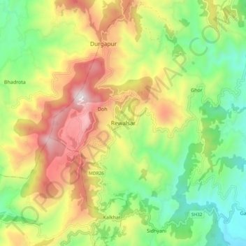
Nom : Carte topographique Rewalsar, altitude, relief.
Altitude moyenne : 1 283 m
Altitude minimum : 814 m
Altitude maximum : 1 927 m