
Carte topographique Lucknow
Carte interactive
Cliquez sur la carte pour afficher l’altitude.
À propos de cette carte
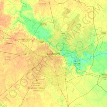
Nom : Carte topographique Lucknow, altitude, relief.
Lieu : Lucknow, Lucknow District, Uttar Pradesh, 226027, India (26.67810 80.77460 26.99810 81.09460)
Altitude moyenne : 120 m
Altitude minimum : 103 m
Altitude maximum : 131 m
Lucknow stands at an elevation of approximately 123 metres (404 ft) above sea level. The city had an area of 402 km2 (155 square miles) until December 2019, when 88 villages were added to the municipal limits and the area increased to 631 km2 (244 square miles).