Géolocaliser

Carte topographique ONL

Carte interactive

Cliquez sur la carte pour afficher l’altitude.

À propos de cette carte

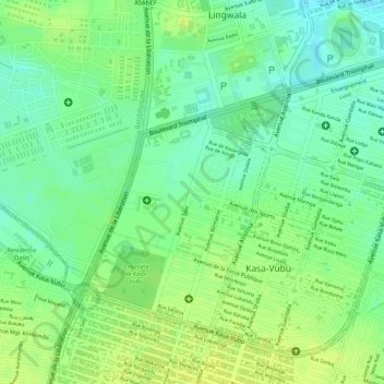
Nom : Carte topographique ONL, altitude, relief.

Lieu : ONL, Kasa-Vubu, Kinshasa, Democratic Republic of the Congo (-4.34663 15.29371 -4.33568 15.30511)

Altitude moyenne : 293 m

Altitude minimum : 282 m

Altitude maximum : 300 m

Autres cartes topographiques

Cliquez sur une carte pour visualiser sa topographie, son altitude et son relief.

Nsele

Democratic Republic of the Congo > Kinshasa

Nsele, Kinshasa, Democratic Republic of the Congo

Altitude moyenne : 431 m

Parc Naturel de la Nsele (Mangiers)

Democratic Republic of the Congo > Kinshasa

Parc Naturel de la Nsele (Mangiers), Nsele, Kinshasa, Democratic Republic of the Congo

Altitude moyenne : 276 m

Amba

Democratic Republic of the Congo > Kinshasa

Amba, Kisenso, Kinshasa, Democratic Republic of the Congo

Altitude moyenne : 353 m

Kinshasa

Democratic Republic of the Congo > Kinshasa

Kinshasa, Aketi, Kinshasa, Democratic Republic of the Congo

Altitude moyenne : 316 m

Lemba

Democratic Republic of the Congo > Kinshasa

Lemba, Kinshasa, Democratic Republic of the Congo

Altitude moyenne : 351 m